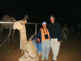
Whitehorse, the largest city in the Yukon at 23,000 people, is the capital of the Yukon Territory. Two-thirds of the Yukon population live in Whitehorse. It is named Whitehorse because of a series of rapids on the Yukon river where the water through the rapids resembles the mane of a horse. It is the closest thing to civilization for hundreds of miles. This is our first internet access in eight days and our first cell phone access in three days.
We went to a wildlife preserve in Whitehorse because we had driven through 800 miles of Canadian wilderness and had not seen an elk, caribou, or moose. We saw lots of elk, caribou, and moose crossing signs but no critters.
We attended a variety show called Frantic Follies Vaudeville Revue. The corny jokes made the show. Drunk French Guy - "I am staying at the Fiddlers Inn." Straight Guy - "Why do they call it the Fiddlers Inn?" Drunk French Guy - "I don't know but it is a vile inn." Drunk French Guy - "I am writing a new song." Straight Guy - "What is the name of your new song?" Drunk French Guy - "The name of my new song is 'Meet me behind the stone crusher, honey, I am a little bolder there.'"
We had our first dinner in a restaurant in several weeks. I had grayling because I had never had grayling before. I tastes alot like trout.
We stopped at the "Welcome to Whitehorse" sign to take photos and while we were taking the photos a woman says to me, "Did you see the baby eagle?" She pointed to a utility pole with an eagle's nest on top. Every few seconds, the baby eagle would raise its head. The nest used to be in a tree but the limb broke. The utility company installed a utility pole and put the nest on the pole.
We arrive in the Yukon.
Whitehorse - Ming is talking to our daughter, Lisa, on her cell phone while we took the photo.
Eagle's nest. The head of the baby eagle is in the center of the photo, to the left of the long pole.
A bull caribou.
Musk ox. Musk ox was on the menu at the restaurant where we dined in Whitehorse.
Two moose hiding in the bushes.
A bull elk relaxing in his pen.
Saturday, July 10, 2010
Thursday, July 8, 2010
The Cassiar Highway
We drove the Cassiar Highway to connect to the Alaska Highway. The Cassiar Highway is 450 miles of remote wilderness - no TV, no cellphone, no internet, almost no gas, and beautiful scenery. We drove 150 miles between gas stations on the first day. The second day, it was almost 90 miles to the next station. We drove by rivers and mountains and lakes. This is the first time we began noticing the long hours of daylight. We walked around our campground at 10:00 at night taking photos of the campground.
The Cassiar Highway.
The Cassiar Highway. There are no utility poles along this section.
These signs are common in the remote areas of Canada. 141 kilometers is 88 miles.
This lake is five minutes from our campsite at Bell II. I caught our dinner here - four small trout. This photo was taken at 5:00pm.
The Bell II lodge. This photo was taken at 10:00pm with heavy cloud cover. It is called Bell II because it is the second crossing of the Bell-Irving River.
The Bell-Irving River. This photo was taken at 10:15pm.
The Cassiar Highway.
The Cassiar Highway. There are no utility poles along this section.
These signs are common in the remote areas of Canada. 141 kilometers is 88 miles.
This lake is five minutes from our campsite at Bell II. I caught our dinner here - four small trout. This photo was taken at 5:00pm.
The Bell II lodge. This photo was taken at 10:00pm with heavy cloud cover. It is called Bell II because it is the second crossing of the Bell-Irving River.
The Bell-Irving River. This photo was taken at 10:15pm.
Vanderhoof to Hazelton
We stayed overnight is Vanderhoof, the geographical center of British Columbia, and then drove to Hazelton. We stocked up on movies in Vanderhoof because we will have no TV access for the next five days. In Hazelton, we stayed at a campground run by First Nation people. There is not much to see or do in Hazelton and it was cold and rainy. We watched lots of movies.
We are in the middle of B.C.
In Hazelton we stayed at the 'Ksan campground. They have historic buildings, a museum, a gift shop, plus the campground, of course.
There are totem poles with snow capped mountains in the background.
This is the view from our campsite.
The Skeena river flows by the campground.
We are in the middle of B.C.
In Hazelton we stayed at the 'Ksan campground. They have historic buildings, a museum, a gift shop, plus the campground, of course.
There are totem poles with snow capped mountains in the background.
This is the view from our campsite.
The Skeena river flows by the campground.
Monday, June 28, 2010
Cache Creek, BC
Crossing the border is always an experience. The Canadians would not let us bring our firewood into Canada. We had to turn around, cross the border back into the US, and unload the firewood. Crossing into Canada is much easier and faster than crossing into the US. It seems there is always a backup getting into the US.
Cache Creek was our first stop in Canada. We stayed there two nights because we wanted to be sure we had time to get to an ATM machine to get some Canadian currency. There was a golf course across the highway from our campground so Ming and I played 18 holes of golf on Saturday. I think Ming enjoyed it more than me. The drive to Cache Creek goes through some beautiful mountain scenery. We drove up Highway 1 and it is cut into the side of the mountains.
We drove to McLeese Lake today. It is three hours north of Cache Creek. I fished for four hours this afternoon and evening and caught a dozen squawfish. Unfortunately, all they are good for is throwing back into the water.
This is Highway 1.
This is also Highway 1. The light horizontal line on the distant mountain in the center of the photo is Highway 1.
The view out our front window. Ming shot the photo as we were driving along.
Another view out our front window.
McLeese Lake. There are a few houses and campgrounds around the lake.
We had an unexpected guest wander through the campground. It is a young bull elk.
Cache Creek was our first stop in Canada. We stayed there two nights because we wanted to be sure we had time to get to an ATM machine to get some Canadian currency. There was a golf course across the highway from our campground so Ming and I played 18 holes of golf on Saturday. I think Ming enjoyed it more than me. The drive to Cache Creek goes through some beautiful mountain scenery. We drove up Highway 1 and it is cut into the side of the mountains.
We drove to McLeese Lake today. It is three hours north of Cache Creek. I fished for four hours this afternoon and evening and caught a dozen squawfish. Unfortunately, all they are good for is throwing back into the water.
This is Highway 1.
This is also Highway 1. The light horizontal line on the distant mountain in the center of the photo is Highway 1.
The view out our front window. Ming shot the photo as we were driving along.
Another view out our front window.
McLeese Lake. There are a few houses and campgrounds around the lake.
We had an unexpected guest wander through the campground. It is a young bull elk.
Thursday, June 24, 2010
Burlington, WA
Burlington is about half way between Seattle and Vancouver. It is a small town and very friendly. People wave when they drive by. We have been stranded here for a week. The truck needed major repairs. We have been sitting around the camper watching TV and eating spaghetti and bear meatballs and bear stew. Thankfully, the freezer was packed with food. We got the truck back yesterday (Wednesday). We have restocked the camper and we are ready to be on the road again.
We had lunch two days in a row at Shari's because the pies are great.
Ming relaxing at our campsite in Burlington.
The campground was surrounded by horse farms. Sometimes the horses would wander by our spot.
We drove through some beautiful places in Washington.
More Washington beauty.
We had lunch two days in a row at Shari's because the pies are great.
Ming relaxing at our campsite in Burlington.
The campground was surrounded by horse farms. Sometimes the horses would wander by our spot.
We drove through some beautiful places in Washington.
More Washington beauty.
Sunday, June 13, 2010
Antelope Island
Antelope Island is the largest island in Great Salt Lake. There is a 7-mile causeway from the mainland to the island. The island has had several owners since the founding of Salt Lake City and was used primarily as grazing land for cattle and sheep. Today the island is a state park.
This is the reason it is called Antelope Island.
The happy tourists. It was cold and rainy. I am wearing two shirts, a sweater, and a raincoat.
The strip of land jutting out from the left is the causeway back to the mainland.
Looking across Great Salt Lake at Salt Lake City. You can see a little of the snow caps through the clouds on the right.
Antelope are not the only wildlife on the island. There are buffalo, big horn sheep, and also chukar.
This is the reason it is called Antelope Island.
The happy tourists. It was cold and rainy. I am wearing two shirts, a sweater, and a raincoat.
The strip of land jutting out from the left is the causeway back to the mainland.
Looking across Great Salt Lake at Salt Lake City. You can see a little of the snow caps through the clouds on the right.
Antelope are not the only wildlife on the island. There are buffalo, big horn sheep, and also chukar.
Salt Lake City, UT
Salt Lake City was founded by The Church of Jesus Christ of Latter Day Saints (also known as the Mormons). It is called Salt Lake City because it is near Great Salt Lake, a lake 2-8 times more salty than the oceans. Salinity varies depending on the distance from the incoming fresh water. The lake is 30 miles wide and over 72 miles long and 10 to 28 feet deep. But its actual size can vary greatly. Great Salt Lake is endorheic meaning it has no outlets other than evaporation.
Temple Square, located in the center of Salt Lake City, is a ten acre tract containing the Mormon Tabernacle, Mormon Temple, two visitor's centers, and a few other buildings. There are free tours of all the buildings except the Tabernacle. The tours all include an attempt at conversion.
The Mormon Tabernacle. The second steeple from the left is topped by a golden angel.
The golden angel atop the steeple.
The pipe organ inside the Temple. This is in the Temple, not the Tabernacle. The Temple has seating for less than 5000 people and is used for church services during the winter months.
During the summer months, services are held in the conference center which is across the street from Temple Square. The conference center seats 21,000 people. The conference center is also used for the Christmas presentation. This photo shows the view from the upper balcony. There are no supporting posts anywhere in the auditorium giving every seat an unobstructed view of the stage.
Here is a closeup of the pipe organ and the seating area for the choir.
Here I am standing in front of the stage looking out at the auditorium seating.
Temple Square, located in the center of Salt Lake City, is a ten acre tract containing the Mormon Tabernacle, Mormon Temple, two visitor's centers, and a few other buildings. There are free tours of all the buildings except the Tabernacle. The tours all include an attempt at conversion.
The Mormon Tabernacle. The second steeple from the left is topped by a golden angel.
The golden angel atop the steeple.
The pipe organ inside the Temple. This is in the Temple, not the Tabernacle. The Temple has seating for less than 5000 people and is used for church services during the winter months.
During the summer months, services are held in the conference center which is across the street from Temple Square. The conference center seats 21,000 people. The conference center is also used for the Christmas presentation. This photo shows the view from the upper balcony. There are no supporting posts anywhere in the auditorium giving every seat an unobstructed view of the stage.
Here is a closeup of the pipe organ and the seating area for the choir.
Here I am standing in front of the stage looking out at the auditorium seating.
Subscribe to:
Posts (Atom)